Magnetic surveying using unmanned aerial vehicles (UAVs) is a highly efficient aerogeophysical technology that provides detailed data on the structure of the magnetic field in remote and extensive areas.
Exploration Service holds an international BARS GOLD certification, confirming the highest standards of safety, risk management, and operational efficiency in field operations.
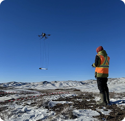
The technology is based on flying over the survey area along predefined маршрутов at ultra-low altitudes, ensuring maximum resolution of magnetic anomalies. The use of UAVs significantly increases the density of field observations while maintaining exceptional safety and accuracy that cannot be achieved by traditional ground survey methods.
During flight, a high-sensitivity magnetometer records field variations which, after processing and correction for variations in the earth’s magnetic field, are used to generate high-precision anomaly maps.
The method is ideally suited for the exploration of ore deposits, mapping of concealed faults, detection of hydrothermal alteration zones, and assessment of geological potential in areas with complex terrain.
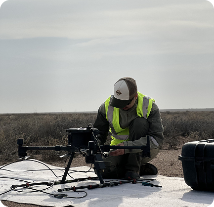
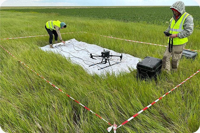
A high-precision Geometrics Magаrrow II magnetometer is used as the primary measurement instrument, featuring ultra-high sampling rates and sensitivity. The instrument is optimized for UAV deployment, eliminating the influence of the carrier’s own magnetic field on measurement results.
The UAV platforms used, including DJI Matrice 300/350, are equipped with RTK high-precision positioning systems, ensuring strict adherence to flight paths and terrain-following altitude through the SkyHub module. Integration with advanced software for pre-flight planning and data processing guarantees reliable results ready for prompt geological interpretation.
All systems undergo thorough calibration prior to field operations, ensuring maximum stability and high quality of the acquired geophysical data.