Electrical surveys

Electrical surveys are a leading geophysical method aimed at studying the distribution of specific electrical resistivity and the polarizability of rocks.

Get a consultation
Methodology and areas of application

Electrical surveys are a leading geophysical method aimed at studying the distribution of specific electrical resistivity and the polarizability of rocks.

This applied geophysical method is based on the analysis of artificially generated electrical fields in the Earth's crust. Determining key physical parameters allows for accurate identification of lithological heterogeneities and fracture zones.

Work is carried out using induced polarization (IP) methods, including the vector modification (Vector IP), the mid-point gradient method (MPGM/IP), and vertical electrical sounding (VES). The applied survey configurations enable detailed line and area investigations of any complexity. The result is a thorough quantitative interpretation with the creation of reliable 2D and 3D models.

Main methods of electrical surveys
Vector Induced Polarization (Vector IP)

This high-tech method is based on recording the full spatial characteristics of the secondary electrical field generated during rock polarization under the influence of current.

The use of vector measurements significantly improves the accuracy of ore body localization and allows for detailed refinement of the spatial geometry of identified anomalies. Results are presented as maps and cross-sections showing the distribution of rock polarizability.

Dipole Electrical Soundings

A modification of the resistivity method, this technique uses a system of separated current and potential electrodes, providing maximum sensitivity to deeply buried lithological heterogeneities.

Dipole configurations enable effective investigation of significant depths while maintaining high resolution for detecting concealed ore bodies and zones of tectonic disturbances. Data interpretation results in detailed geo-electrical cross-sections, which serve as the basis for building 3D geological models of deposits.

Mid-Point Gradient Induced Polarization

This method is an effective technique for area surveys, ideally suited for rapid detection and outlining of large mineralized zones across extensive territories.

Due to the stability of the primary field in the central part of the installation, the method ensures high reliability when mapping ore clusters and identifying regional metasomatic alteration zones. Final maps of polarizability parameters allow for precise delineation of prospective areas for subsequent detailed geophysical investigations.

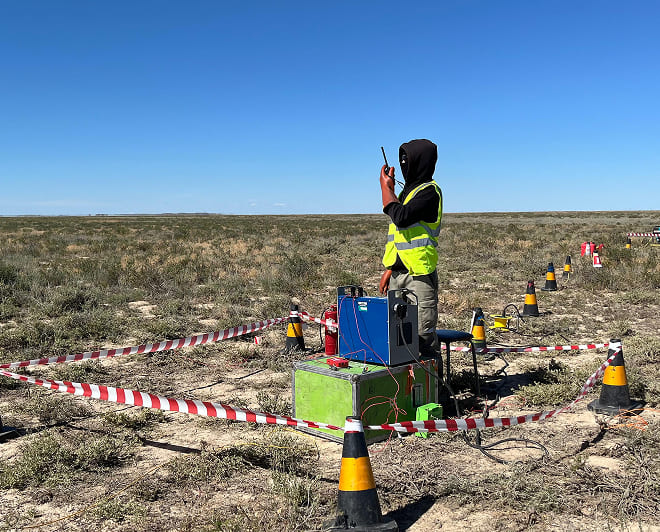
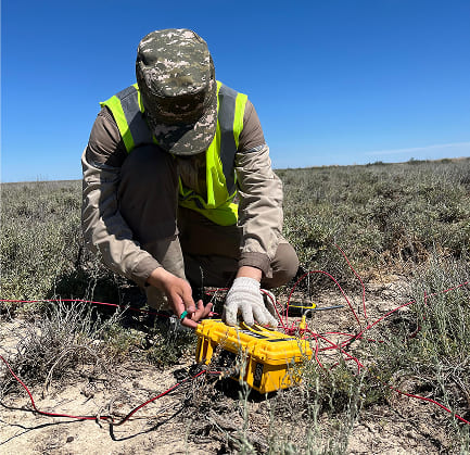
Equipment and technical facilities

Modern digital recording equipment is used for electrical surveys, ensuring high measurement accuracy and stable current parameters in field conditions.

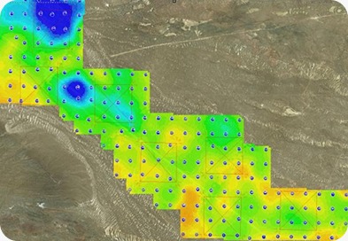
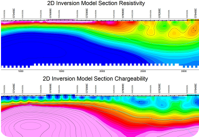
High-tech measurement systems

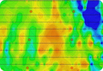
The core of our instrument fleet consists of GDD Receiver multichannel measurement systems and next-generation GDAS-32 recorders. These systems feature exceptional noise immunity and can extract useful signals even in the presence of strong industrial interference and complex geo-electrical sections.
A wide dynamic range and high sampling rate enable the acquisition of highly detailed information on induced polarization and resistivity parameters, which is critical for the detection of deeply buried ore bodies.

Powerful transmitting units

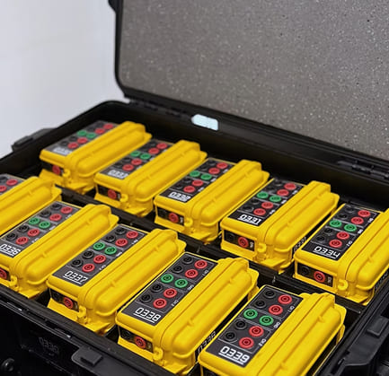
Specialized transmitters of the Zonge Transmitter series are used to ensure stable generation of the electromagnetic field, having proven themselves as global standards of reliability. These units provide stable pulsed current of the required power, ensuring reliable performance in areas with low conductivity of near-surface layers.
Intelligent current control systems allow precise maintenance of excitation cycles, ensuring excellent repeatability of results and high-quality primary field data throughout the entire project duration.

Need a consultation?

Leave a request, and our specialists will contact you for consultation and clarification of your objectives. We will provide the optimal solution considering the goals and specific features of the site.

By clicking the “Send” button, you agree to the Privacy Policy