Digitization and interpretation of historical data

Digitization of historical geophysical and geological data involves a comprehensive set of tasks aimed at converting archival materials from past years into modern digital formats suitable for in-depth quantitative interpretation.

This process allows archival information to be transformed and enables the use of exploration results from previous decades to support current investment decisions in the search for mineral deposits.

Get a consultation
Methodology and areas of application

The technology includes vectorization of graphic materials (maps, cross-sections, logging diagrams), digitization of field journals, and unification of heterogeneous data into a single geodetic and coordinate framework.

The process concludes with the integration of the resulting digital datasets into modern software systems for constructing three-dimensional models of deposits.

The service is in demand for license area reassessment, analysis of the effectiveness of past geological exploration, and identification of previously overlooked prospective anomalies.

Main processing methods
Vectorization and georeferencing of cartographic materials

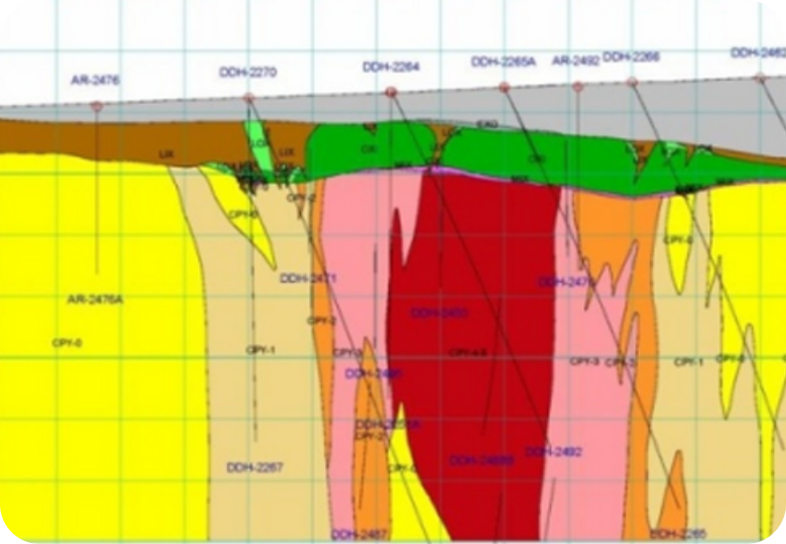
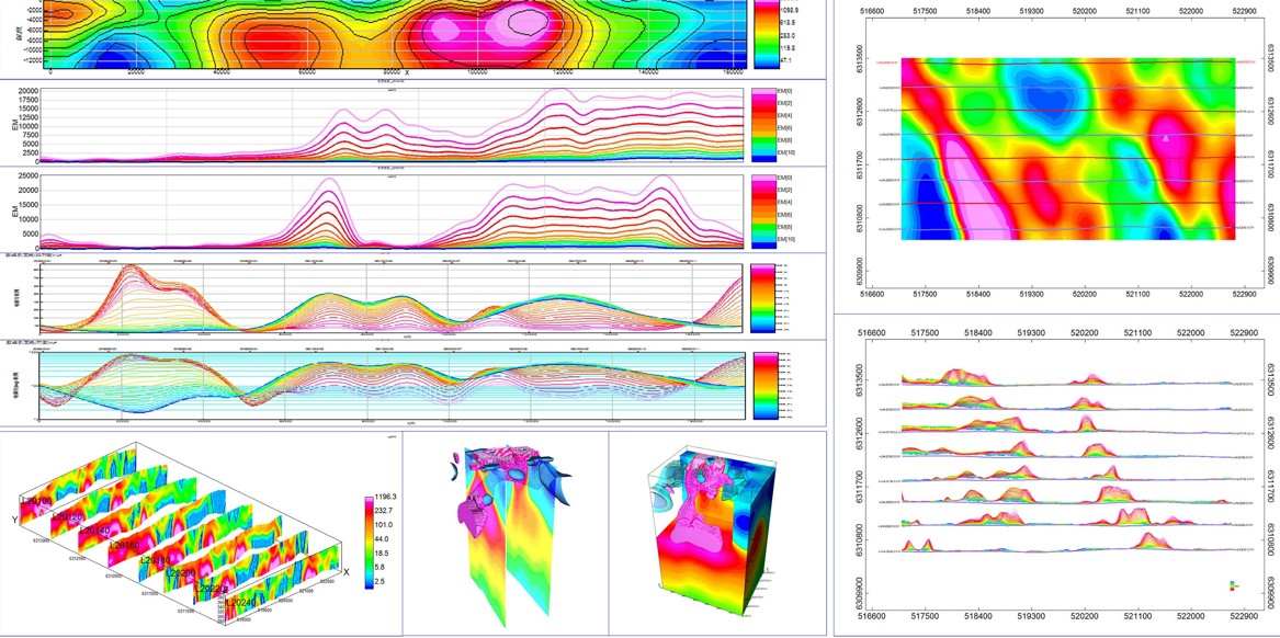
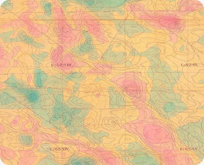
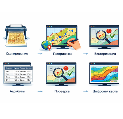
An automated method for converting paper maps, plans, and diagrams into vector format with precise spatial referencing to a modern coordinate system. High-quality vectorization ensures that all details of the original material are preserved, which is critical for the analysis of the structural and tectonic framework of the surveyed area.

Digitization and reinterpretation of geophysical cross-sections

Conversion of archival analog charts and cross-sections into digital formats allows for re-inversion and mathematical processing of the data. The method enables the application of modern processing algorithms, which significantly enhance the resolution of historical data and refine the parameters of ore bodies.

Database creation and 3D modeling

Systematization of accumulated geological information into unified, structured databases ready for integration into modern 3D modeling systems. The construction of volumetric models based on combined historical and new data minimizes geological risks and allows for precise planning of drilling volumes.

Data processing software systems

Modern vectorization systems and specialized GIS packages (such as ArcGIS and Leapfrog) are used for subsequent data analysis and integration.

Regular quality control at each stage of digitization prevents errors and ensures high accuracy of the final digital product.

Need a consultation?

Leave a request, and our specialists will contact you for consultation and clarification of your objectives. We will provide the optimal solution considering the goals and specific features of the site.

By clicking the “Send” button, you agree to the Privacy Policy